Water Resources Engineering
Managing the Flow
Water is the source of life, but when unharnessed can bring destruction. We help our clients gain control of this vital resource with intelligent, responsible solutions for water conservation, stormwater management, erosion mitigation, and flood protection.


Our expertise
Water management and resiliency are keys to our future. Water demands to serve growing populations, water management to sustain and preserve our water sources, protection from intensifying storms and maintaining our water infrastructure is core of our Water Resources Engineering expertise. Our engineers combine deep experience and expertise in leading technologies to solve the growing water resource challenges the world faces today. Using geographic information systems, radar-sourced rainfall data, and steady- / unsteady-state modeling of surface, channel, and pipe flow, we design solutions to provide and protect water sources, protect people and property from flooding, and improve our water infrastructure. Our team also provides emergency response services to help authorities secure sites, assess damages, and plan for repairs.
Floodplain Management
We collaborate with public and private clients to define flood vulnerable areas and find solutions to provide protection. Our engineers and technicians develop floodplain information to better communicate and educate citizens. We collaborate with our partners within and outside of the firm to develop designs to protect infrastructure, prevent adverse impacts from new projects, and save lives. We give back to the community with helpful information such as our free Harris County Floodplain Elevation Tool which provides a map based online tool to identify FEMA 10–500-year floodplain elevations, floodplain limit maps, stream cross sections, hydraulic models, and stream profiles from the current effective flood insurance studies for use in planning, regulating, and educating by agencies, engineers, surveyors and the public at large.
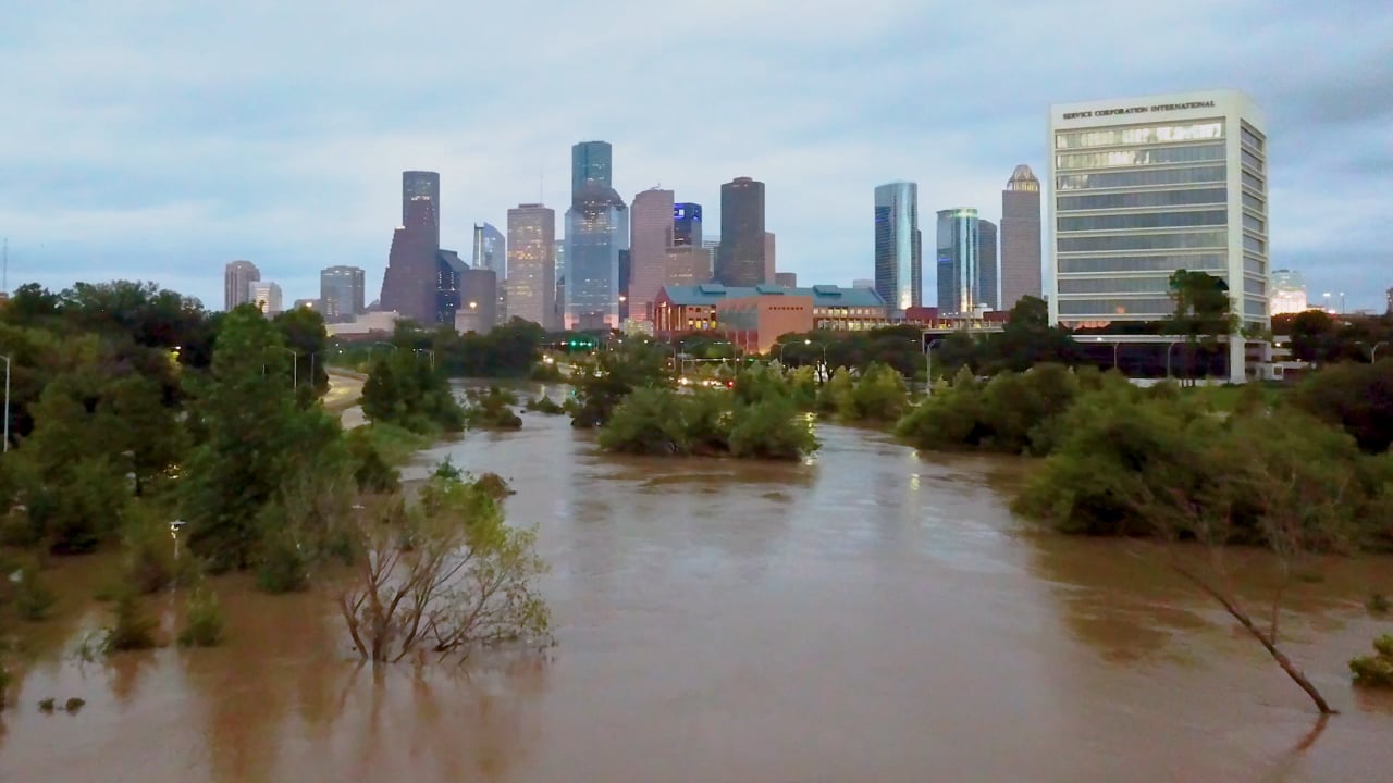
Flood Protection
We evaluate vulnerabilities, map risks, and design resilient defenses to safeguard people, infrastructure, and vital resources from flooding. From advanced modeling to on-the-ground emergency response, we help communities prepare for, withstand, and recover from escalating flood threats.
Storm Water Services
We help communities manage and treat storm water employing cost-effective and sustainable designs, working closely with community planners to capture the aesthetical benefits of our waterways. The storm water system designs create vibrant built environments that protect citizens, structures, and receiving streams. Our team employs the latest hydrology and hydraulic techniques, drainage modeling, policy criteria, and design innovations to help urban areas thrive in harmony with nature.
Water Supply
Water is precious resource that is necessary for a community to thrive. The systems to capture, collect, treat and convey water is the heart of every municipality. It is becoming more and more imperative to conserve water sources in a balance with nature. Our team helps clients develop strategies and design comprehensive systems for water supply using potable and non-potable systems to meet demands. We help navigate system designs through regulatory requirements of multifaceted systems to meet grow water supply needs sustainably and effectively. Our focus is to secure reliable, efficiently managed water supplies that can meet increasing demands and serve future generations.
Dam Safety
Water capture using dams is an age-old proven water supply method, and because of that many of the dams are old and in need of inspection and maintenance. Walter P Moore combines its intensive expertise in civil, structural, and water resources engineering to help clients evaluate and enhance the integrity of their dams for operational and regulatory purposes. Our guidance helps public and private owners and operators meet the latest regulatory requirements and bring assurance to the public that land, property, and people near their dams are protected.
Flood Warning Systems
Floods are the costliest disasters each year. Often the ability to protect property and lives comes down to ample real time warning so that protection can be put in place and people can get out of harm’s way. Our team helps governments and private organizations provide the public with flood information and alerts in real time. We gather live rainfall data during storms and run models in real time to develop accurate estimates of flood levels in streams and at water crossings so appropriate flood action can be taken to provide protection.
Floodplain Elevation Tool
To aid in urban development and flood risk evaluation, we developed a floodplain elevation tool that incorporates Harris County and City of Houston floodplain regulations. The tool features FEMA 10–500 year frequency floodplain elevations, stream flood profiles, mapped floodplain limits, stream cross sections, hydraulic models, elevations, and effective stream profiles from flood insurance studies. Viewing the tool requires a simple registration process.